I drove a series of switchbacks up 89A to the Oak Creek Canyon overlook to see all the snow. Driving down from the Colorado Plateau was fun. It is located in the Coconino National Forest.


I drove a series of switchbacks up 89A to the Oak Creek Canyon overlook to see all the snow. Driving down from the Colorado Plateau was fun. It is located in the Coconino National Forest.
Fay Canyon is a small canyon that supports a diverse community of desert plants. It dead ends at a red Supai sandstone cliff. Going beyond the end of the trail provides the best views. This time I went up the north branch of Fay Canyon. Last spring I explored the south branch.


 |
| I've explored the north and south branches of Fay Canyon. |
This morning I hiked out to the Sinagua ruins in Long Canyon. It's a difficult hike on a faint trail which requires scrambling, climbing, and bushwhacking. It was 2.4 miles from where I parked, and took me 96 minutes to reach the ruins. The ascent is 1,170 feet from the road where I parked.


 |
| This is where I had left the trail. |
I always enjoy a stroll around Montezuma's Well.
"More than 10,000 years ago, the Well’s water fell as rain and snow atop the Mogollon Rim. Over millennia, it has percolated slowly through hundreds of yards of rock, draining drop by drop through the path of least resistance. But here the water encounters an obstacle much harder than the others through which it has flowed. Beneath the Well, a vertical wall of volcanic basalt acts like a dam, forcing water back toward the surface. In its long trip toward daylight, it eroded an underground cavern until its roof collapsed and created the sinkhole you see today. Every day, the Well is replenished with 1.5 million gallons of new water. Like a bowl with a crack in its side, the water overflows through a long, narrow cave in the southeast rim to reappear on the other side at the outlet." - NPS

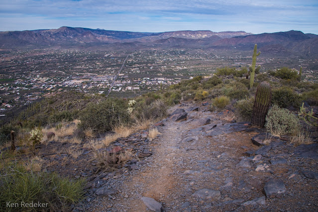
The ascent to the summit is about 1,100 feet in only 1.2 miles. The trail is easy but very steep. Took me an hour to get on top.
The name of Black Mountain comes from the western side where very dark gray to black phyllite and meta-argillite crop out. Many people mistake it for basalt which is common in the area. The east side of the Mountain exposes coarse-grained granite.
From about 1450 to the 1870s the area was considered Apache territory. Evidence of the Hohokam living in the Black Mountain area disappears around 1450 A.D.


 |
| The 2.3 mile round trip trail. |