Tuesday, March 30, 2021

South Fork Alamo Canyon - Organ Pipe Cactus National Monument

I had never been down the south fork of Alamo Canyon, and couldn't find any information about it. So this was an exploratory hike for me to see how far I could travel within the canyon. I followed the Alamo Canyon Trail from the campground to where the canyon splits going north and south. Both directions have no trail beyond this point. At 1.76 miles down the south fork my progress was blocked by boulders the size of trucks. At that point I climbed up out of the canyon heading east so I could get a view of the surrounding area. Next, I followed a drainage toward a narrow canyon. Inside the canyon I encountered a pour-off that I was unable to climb, but I was able to climb around it on the left side. That is where I turned around. Later I read that this is a route to Peak 3940. I will return in the fall and bag that peak.

The south fork of Alamo Canyon.

Climbing out of Alamo Canyon.

Climbing out of Alamo Canyon.

Climbing out of Alamo Canyon.

Looking down at Alamo Canyon.

Looking down at Alamo Canyon.


Looking down at Alamo Canyon.


Looking down at Alamo Canyon.

I turned back after I found a way through this canyon.

My 4.6 mile route.

Monday, March 29, 2021

Attempt on Diaz Peak - Organ Pipe Cactus National Monument

I had set out on an attempt to climb Diaz Peak at Organ Pipe Cactus National Monument. I didn't have much information about the hike other than a brief trip report and a route from the Peak Bagger website. So I followed the service road, but I over shot the north rib of the mountain I wanted to ascend. By the time I was on the north rib, it was getting too late to summit the peak. I'll come back in the fall when temperatures are cooler. I ended up hiking 7.4 miles round trip because of my error.


Looking back at the service road.

Looking back at the service road.

The view from the base of the north rib of Diaz Peak.

My 7.4 mile round trip route.


Sunday, March 28, 2021

Gunsight Wash BLM - Why, Arizona

This is a very nice area for dispersed camping. It's quiet and clean. It also has good 5G cell service. 


Wednesday, March 24, 2021

The Limestone Trail - Tonto National Forest

I hiked a 6.1 mile loop on the Limestone Trail. I had done it once before, but this time I wanted to hike it in the late afternoon. So I started at the Spur Cross Ranch Conservation Area at 4pm, and finished shortly after sunset. It took me 3 hours and 11 minutes.

Skull Mesa


View from the Limestone Trail.


Limestone Spring


My 6.1 mile route.

Thursday, March 18, 2021

Dome Mountain and Peak 3269 - Goldfield Mountains

I like to have a challenging goal for a hike. This time it was bagging at least 2 peaks. First, I hiked up Dome Mountain, and after that I headed south a half mile off-trail to Peak 3269. It looked tough and foreboding with outcrops of rhyolite to navigate around. I paused several times, and despite my urge to turn back, my feet kept taking me closer to the mountain. I had come this far may as well go farther. It got harder but I kept going. Finally I climbed up the summit of Peak 3269, and encountered a raven poised on the summit cairn. It flew away, and I tagged the top. But I had to return the same way and hike up Dome Mountain again and back to the trail. The 8.2 mile round trip hike took me 7 hours and 17 minutes. Dome Mountain is the highest point in the Goldfield Mountains at 3,381 feet, with 1,201 feet of prominence, and directly south is Peak 3269 at 3,269 feet.

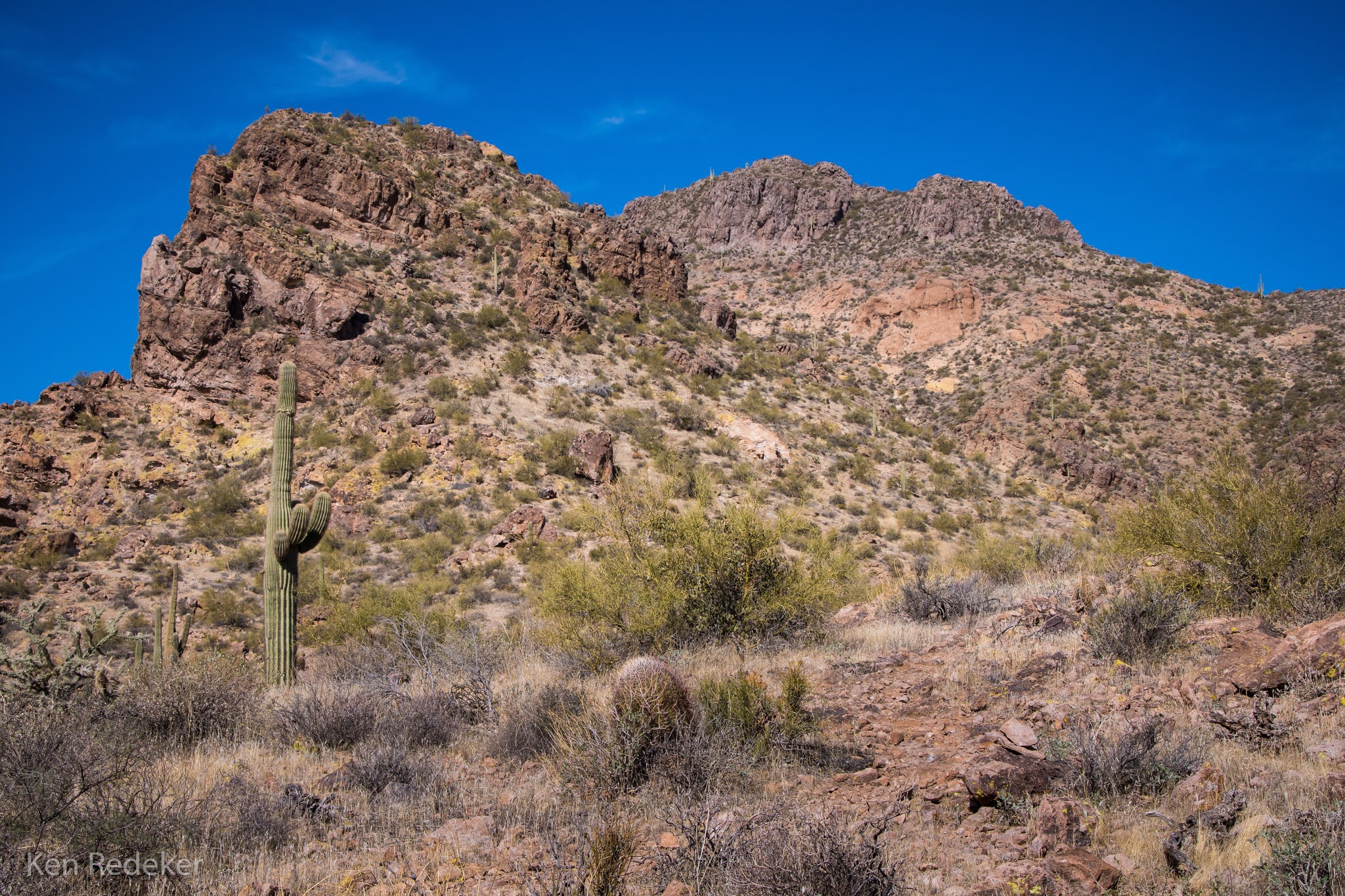
Dome Mountain on the right.

Dome Mountain


Dome Mountain


Peak 3269


Peak 3269

Dome Mountain

Dome Mountain

Dome Mountain

Dome Mountain

Dome Mountain

Me on the summit of Dome Mountain signing the register.

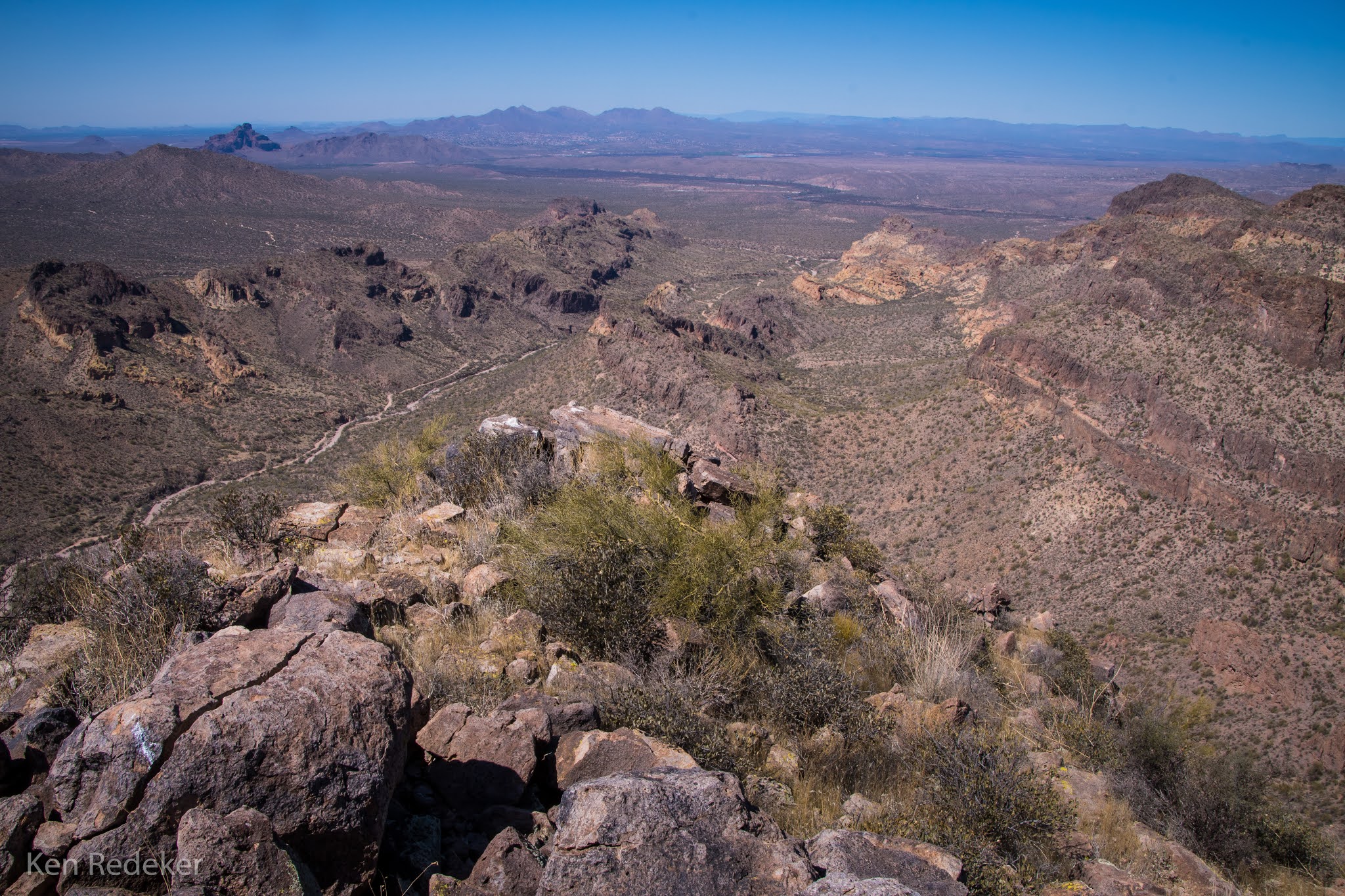
View from Dome Mountain.

Looking back at Dome Mountain.

Looking back at Dome Mountain.

A raven perched triumphantly on the summit cairn of Peak 3269.

Me on the summit of Peak 3269.

View from Peak 3269.

Looking at Dome Mountain as I descend Peak 3269.

Dome Mountain

Peak 3269

Coming down Dome Mountain.


The Superstition Mountains

My 8.2 mile route.