Showing posts with label Grand Canyon National Park. Show all posts

Thursday, May 8, 2025

Grand Canyon National Park

I hiked the South Kaibab Trail to the Tonto Trail, and followed that west to the Bright Angel Trail where I exited the canyon. My hike was 14.9 miles, and it took me 9.5 hours.

At 6:00 AM, I had caught the Hikers Express Shuttle Bus to the South Kaibab Trailhead. At the trailhead I hoisted my heavy day pack over my shoulders, and started my hike at 6:38 AM, at 7,207-feet elevation.

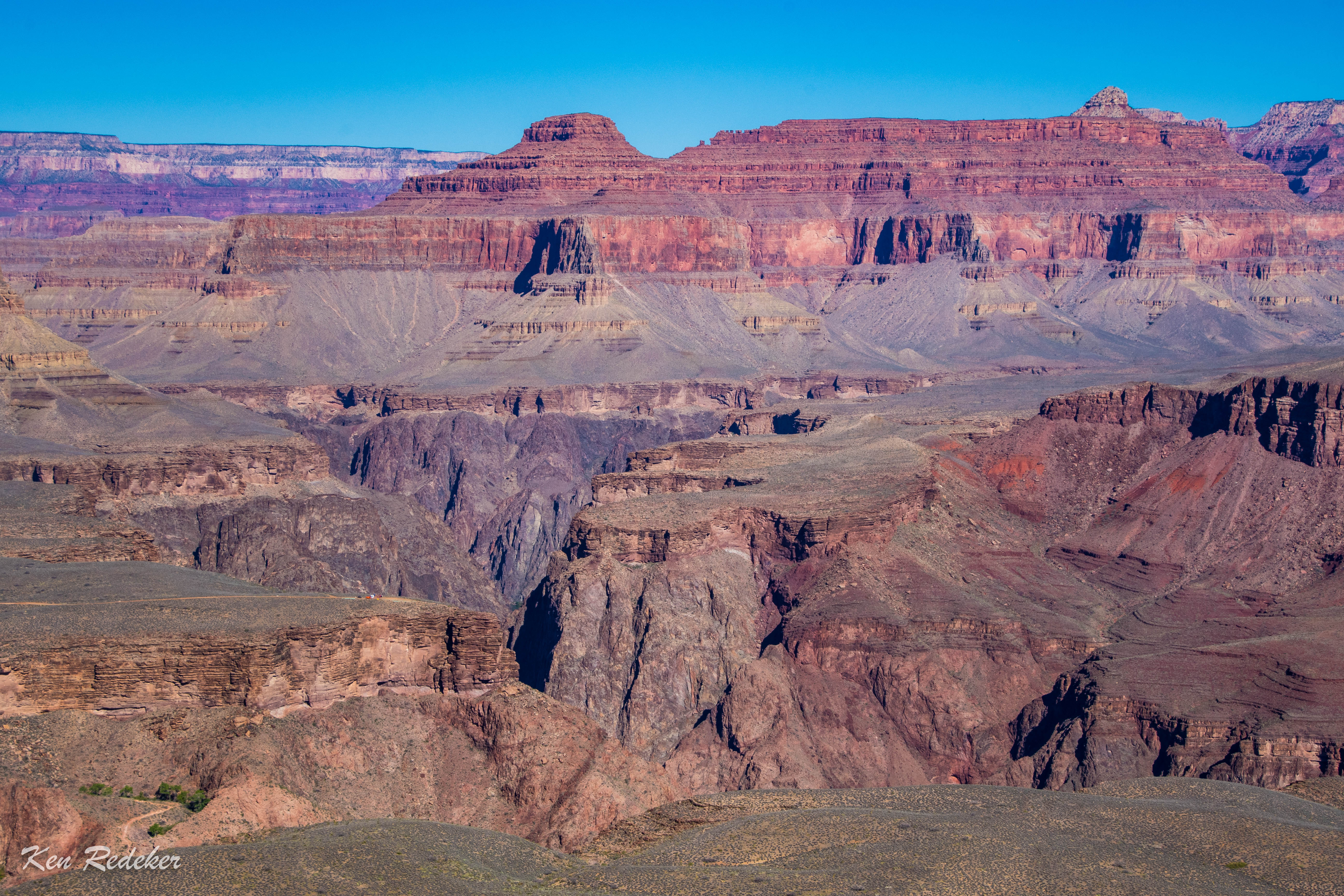
My first stop was Ooh Aah Point at 0.9 miles from the trailhead. It took me 22 minutes to get there. Next was Cedar Ridge at 1.5 miles. I got there at 7:25 AM. Then at 8:21 AM I arrived at Skeleton Point which was 3 miles from the trailhead. Finally, at 9:18 AM I arrived at The Tipoff. It had taken me 2 hours and 38 minutes to get there. At this point I was 4.5 miles from the trailhead. Here I took a 15 minute break at the shelter. The elevation was 3,988-feet.

After a 15 minute break, I started hiking the Tonto Trail. It was 4 miles to the Bright Angel Trail. I arrived at Havasupai Gardens at 12:07 PM. I had hiked 10 miles from the South Kaibab Trailhead. Here I took a one hour lunch break, and began hiking again at 1:07 PM. I reached the 3 Mile Resthouse at 2:02 PM. Right away I took a short break, and refilled my water. At 3:02 I reached the 1.5 Mile Resthouse. At once I took another short break, and refilled my water. I had been on the trail for 8 hours and 23 minutes. At 4:14 PM I was back on the South Rim. My hike had taken me 9.5 hours.


Monday, August 16, 2021

Hermit Trail to Breezy Point - Grand Canyon National Park

My 11 mile round-trip hike on the Hermit Trail to Breezy Point was easy going down but terribly exhausting going back up to the rim. The trail drops 2,200 feet from the South Rim to Breezy Point. It took me 3.5 hours to reach Breezy Point, and 6.5 hours to get back up to the rim. The last mile was the most difficult. I didn't see anybody on the trail. So nice to have complete solitude. The trail going back up was so fatiguing that I forgot I had OCD. Although I wasn't happy about my very slow pace. But the entire hike was without a doubt certainly worth the minor foot pain, and complete exhaustion.

My first target along the trail was Santa Maria Spring, a permanent water source next to a shelter, which is reached after 2.2 miles and a 1,640 foot descent. It took me 1 hour and 10 minutes to reach the spring. My second destination was 1.5 miles further and about 400 feet lower at Lookout Point. Then 1.8 miles to Breezy Point, my turn around destination, and about 220 feet lower.

The trail descends the white Coconino Sandstone, and then weaves along the sloping red layers of the Supai formation until reaching Breezy Point.


Santa Maria Spring and shelter at 2.2 miles from the trailhead.

The shelter at Santa Maria Spring.


The trail goes along the Supai formation.

Breezy Point on the right.

The Supai Formation


The view from Breezy Point.

Looking back at Breezy Point.

Looking back at the trail along the Supai formation.


Looking back at the trail along the Supai formation.

The blue route is my 11 mile round-trip hike.