 |
| My 10.5 mile route. |
Thursday, December 5, 2019
McDowell Sonoran Preserve
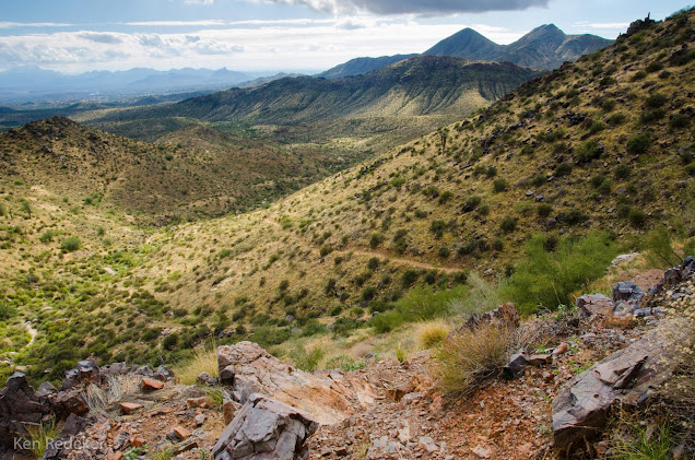
On December 5, 2019, I did a 10.5 mile hike at the McDowell Sonoran Preserve. I began my hike at Tom's Thumb Trailhead, then connected to the East End Trail, then to Windgate Pass Trail, then back to Tom's Thumb Trail, and to the Lookout at 3,858 feet elevation, and finally back to Tom's Thumb Trailhead.
Sunday, December 1, 2019
Sunset Crater Volcano National Monument
On the morning of December 1st, I drove from Phoenix to Sunset Crater Volcano National Monument to
photograph the 18 inches of snow they had received two days ago. From Phoenix, to Flagstaff it's only 130 miles. I moved from Illinois, to escape the snow, and I still like to see it, but only for one day. After having dinner in Flagstaff, I returned to the much warmer Sonoran Desert.
When I lived in Arlington Heights, Illinois, I used to get depressed every winter, and my OCD usually became worse. However, living out of my Honda CRV near Phoenix during the winter, has mostly eliminated my depression. It's still there in the morning, but goes away much quicker with the sun beaming through the car windows at sunrise, and directly on my face. However, winter is the second rainy season in the Sonoran Desert, but the occasional cloudy skies, rain, and flash flood warnings are easier to deal with, and the desert is beautiful after a heavy rain. If I want to see snow I can just drive up to the Colorado Plateau or the Mogollon Rim.
When I lived in Arlington Heights, Illinois, I used to get depressed every winter, and my OCD usually became worse. However, living out of my Honda CRV near Phoenix during the winter, has mostly eliminated my depression. It's still there in the morning, but goes away much quicker with the sun beaming through the car windows at sunrise, and directly on my face. However, winter is the second rainy season in the Sonoran Desert, but the occasional cloudy skies, rain, and flash flood warnings are easier to deal with, and the desert is beautiful after a heavy rain. If I want to see snow I can just drive up to the Colorado Plateau or the Mogollon Rim.
 |
| Sunset Crater Volcano |
 |
| The Bonito Lava Flow |
 |
| The Bonito Lava Flow |
 |
| The Bonito Lava Flow |
Walnut Canyon National Monument
On Sunday, December 1st, I drove to Walnut Canyon National Monument from warm and sunny Phoenix. Walnut Canyon is located about 10 miles southeast of Flagstaff. The canyon rim elevation is 6,690 feet and the canyon floor is 350 feet lower. During the 1100s, many of the Sinagua constructed cliff dwellings in the limestone alcoves. They lived here for about 150 years.
Saturday, November 23, 2019
Ford Canyon Loop Trail - White Tank Mountain Regional Park
On November 23rd, I hiked the 9.7 mile, Ford Canyon Loop Trail. The canyon stream bed is lined with white granite slabs that form pools of water. This is how the name came about. After exiting Ford Canyon, I returned to my car by hiking down Willow Canyon. It was long and difficult hike, but hikes like these make me the happiest, and really lower my anxiety form OCD.
 |
| The route. |
Sunday, November 17, 2019
Weaver's Needle Loop - Superstition Mountains
I hiked 12.4 miles around Weaver's Needle. Most people only hike to the Fremont Saddle, which has incredible views, but if you want solitude keep going and do the long hike around the Weaver's Needle. After descending Fremont Saddle, I only passed one person on this hike. I enjoy the sense of isolation; it gives me the opportunity to restore my body, and most importantly my mind. I feel replenished when I get back to my car, and it lasts for a couple days, or at least until I return to work at Walmart.
Wednesday, November 13, 2019
Wild Burro to Wild Mustang Trail Loop - Tortolita Mountain Park
The trails in the Tortolita Mountains range from 2,800 to 4,300 ft. elevation. Many of the trails
can be accessed by following Dove Mt. Road to the roundabout; there will
be a trailhead parking lot with restrooms just after driving through
the entrance gate to Ritz Carlton Hotel. I wish there was not a Ritz Carlton Hotel here. The smallest of Tucson's mountain ranges, the Tortolitas feature rugged
peaks, gullies, canyons and alluvial fans, with rocky soil and vast
stands of cacti.
 |
| Crested Saguaro |
 |
| The route I hiked. |
Subscribe to:
Posts (Atom)


