Friday, April 9, 2021

Sunrise Peak - McDowell Mountains

This was an easy hike to the 3,069 foot summit of Sunrise Peak. I started at the Lost Dog Trailhead and followed the Sunrise Trail. I made it to the summit in 1 hour and 47 minutes. It was 6 miles round trip with 1,338 feet of elevation gain. The round-trip hike took 3 hours and 13 minutes.


Ocotillo in bloom.

Looking back at the trail.

Me on the summit.

View from the summit.


Wednesday, April 7, 2021

Capitol Butte - Sedona, Arizona

I hiked and climbed up Capitol Butte (Thunder Mountain) in Sedona to the 6,355 foot summit. It's a class 3 climb on a faint and unmaintaned trail. It took me 6.5 hours and it was only 3.9 miles round trip. Lots of class 3 climbing. I didn't see a single person on the trail. Beautiful trail to get away from the Sedona crowds.

Capitol Butte is notorious for causing hikers to get into trouble, and requiring rescue. Therefore I was extra cautious, and had no problems other than briefly losing the trail several times. But I always backtracked to the last rock cairn to figure it out or consulted my map and location on my phone. The steepest is climbing the Coconino Sandstone to the summit.

Heading up the trail.

 
Heading up the trail.

Looking back at the trail.

The view from the trail.

Class 3 climb to the summit.

Class 3 climb to the summit.

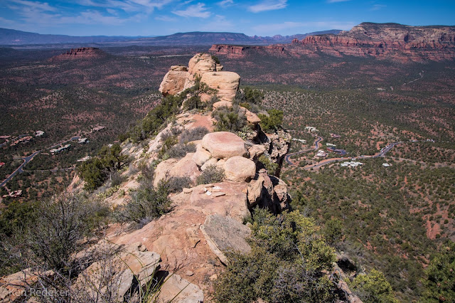
View from the summit.

View from the summit.

Me on the summit.

Humphrey's Peak from the summit.

The top of Capitol Butte.

The route down.


The route down.


Capitol Butte from the trail.

My route.

Dugas Road Campsite - Prescott National Forest

I camped in the Prescott National Forest off I-17 on Dugas Road at 3,900 feet elevation. I was heading to Cottonwood and Sedona. I wanted to climb Capitol Butte.


Sunday, April 4, 2021

Granite Mountain Hotshots Memorial Trail - Yarnell, AZ

I hiked the Granite Mountain Hotshots Memorial Trail for the second time. On June 30, 2013, the Yarnell Hill Fire overran and killed 19 members of the Granite Mountain Hotshots. It's a beautiful trail with amazing views, and a very nice memorial. I hiked 5.8 miles round trip in 3 hours and 13 minutes.


Tuesday, March 30, 2021

South Fork Alamo Canyon - Organ Pipe Cactus National Monument

I had never been down the south fork of Alamo Canyon, and couldn't find any information about it. So this was an exploratory hike for me to see how far I could travel within the canyon. I followed the Alamo Canyon Trail from the campground to where the canyon splits going north and south. Both directions have no trail beyond this point. At 1.76 miles down the south fork my progress was blocked by boulders the size of trucks. At that point I climbed up out of the canyon heading east so I could get a view of the surrounding area. Next, I followed a drainage toward a narrow canyon. Inside the canyon I encountered a pour-off that I was unable to climb, but I was able to climb around it on the left side. That is where I turned around. Later I read that this is a route to Peak 3940. I will return in the fall and bag that peak.

The south fork of Alamo Canyon.

Climbing out of Alamo Canyon.

Climbing out of Alamo Canyon.

Climbing out of Alamo Canyon.

Looking down at Alamo Canyon.

Looking down at Alamo Canyon.


Looking down at Alamo Canyon.


Looking down at Alamo Canyon.

I turned back after I found a way through this canyon.

My 4.6 mile route.

Sunday, March 28, 2021

Gunsight Wash BLM - Why, Arizona

This is a very nice area for dispersed camping. It's quiet and clean. It also has good 5G cell service. 


Wednesday, March 24, 2021

The Limestone Trail Loop - Tonto National Forest

I hiked a 6.1 mile loop on the Limestone Trail. I had done it once before, but this time I wanted to hike it in the late afternoon. So I started at the Spur Cross Ranch Conservation Area at 4pm, and finished shortly after sunset. It took me 3 hours and 11 minutes.

Skull Mesa


View from the Limestone Trail.


Limestone Spring


My 6.1 mile route.