Thursday, October 15, 2020

Atascosa Peak - Coronado National Forest, Arizona

I hiked and climbed up Atascosa Peak on October 15th. It is located in the Coronado National Forest. No trail from the Lookout to Atascosa Peak, except for the occasional rock cairn. Summit is 6,440 feet. It was 7.4 miles round trip. The Lookout is halfway. It took me 7 hours. In 1968 Edward Abbey staffed the fire lookout. Unfortunately, it was destroyed by the 2011 Murphy Complex Fire. 

The Atascosa Mountains are part of the central ranges of the Tumacacori Highlands on the Arizona-Mexico border. The vegetation is scattered evergreen oak woodlands on north facing slopes with scrub-grasslands on south facing slopes. Mesquite and acacia shrubs are common, as are agaves and sotols.

Ruby Road


Atascosa Lookout

Atascosa Peak


On the summit.

On the summit.

On the summit.

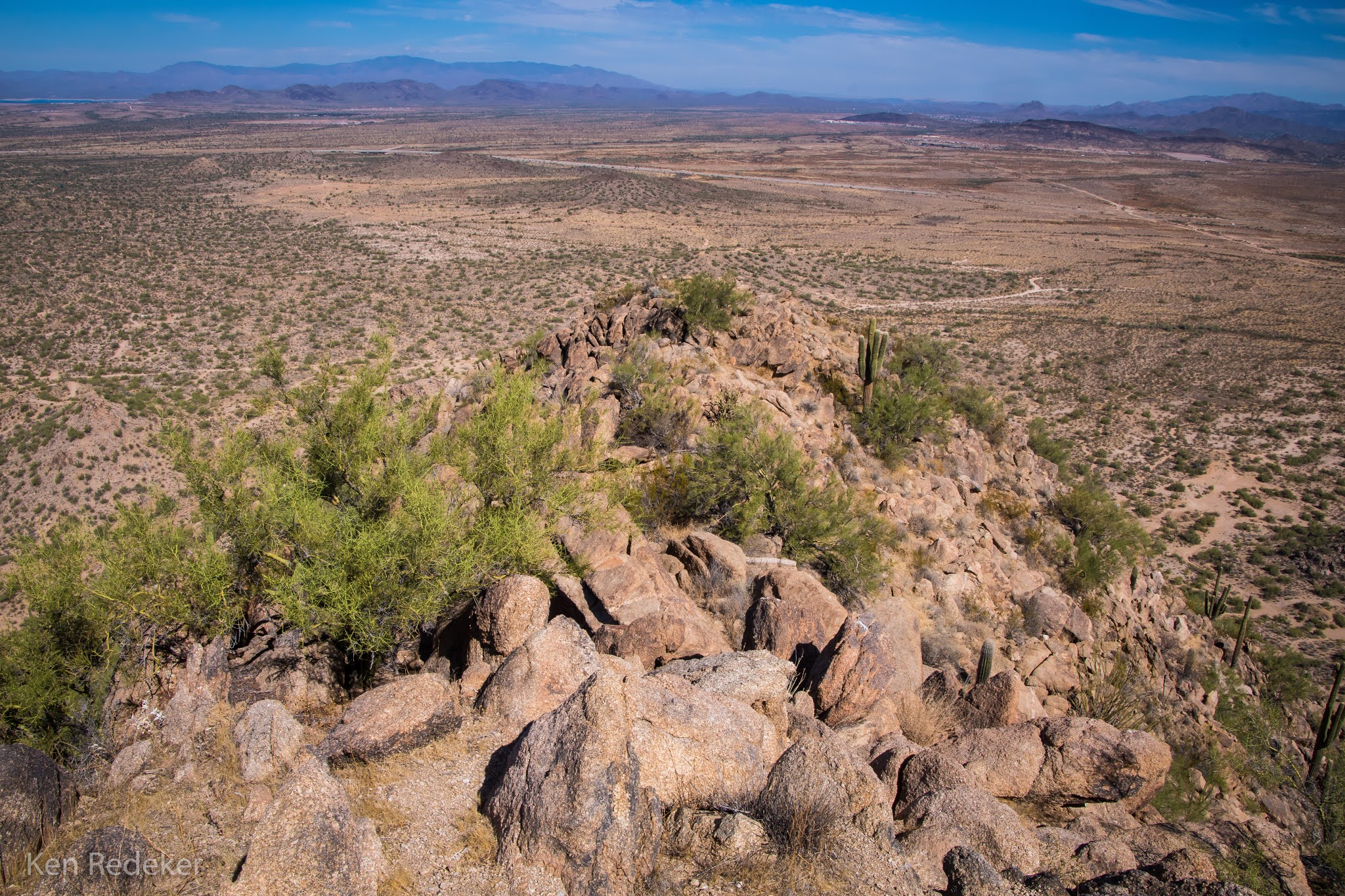
The ridgeline I traversed.


Atascosa Peak


My car at the trailhead parking.


Wednesday, October 14, 2020

Mount Hopkins Road - Amado, Arizona

Camped along Mount Hopkins Road at the base of the Santa Rita Mountains. I'm on the phone with a friend of mine from Illinois. I had 25 years of sobriety in October, and I am speaking with Greg D. from my Wanderer's Group from Alcoholics Anonymous. The Wanderer's are in Illinois, and I miss everyone from our small group. Talking to them keeps me sober. I have known them for more than 20 years.


Neon Sign Park - Casa Grande, Arizona

Stopped at the Neon Sign Park in Casa Grande this morning. I need to come back here at night when the signs are lit up. It is located in the Downtown Arts and Culture District. I enjoy visiting historic roadside treasures.


Jim Kortsen West Pinal Park - Stanfield, AZ

Camped at West Pinal Park Campground last night. On my way to the Coronado National Forest today, to go hiking near the border. Even though it's right by I-8 and route 84 it is very quiet. I was the only one in the campground. Been here many times while traveling, and always nearly empty. Nice place for one night.

I drove here last night from Walmart in Peoria. It's a one hour drive south, and the drive is nice after 10pm, and I don't have to deal with heavy traffic in Phoenix. Got four days off from work. So nice to get away from Walmart.


Friday, October 9, 2020

Pyramid Peak - Peoria, Arizona

I hiked up Pyramid Peak to the 2,260 foot summit. It was 4.9 miles round trip from the Deem Hills parking lot with a 750 foot elevation gain, which was mostly the last mile. Unlike most mountains in the North Valley which are composed of basaltic lava summits, Pyramid Peak is composed of Porphyritic granite, weathered into spherical boulders.

The easiest route is a class 2 scramble up the northeast face, but I veered too far west and encountered a very steep boulder climb. On the way down I angled too far east and encountered lots loose scree. I needed to be somewhere in the middle for the safest route, but I still had no problems.

Have to cross the CAP Canal

Pyramid Peak

Starting the climb.

Very steep climb.

Very steep climb.

On the summit.

Me on the summit.

On the summit.


My route.


Wednesday, October 7, 2020

Turk's Head - Superstition Mountains

Turk's Head can be accessed from either the Hieroglyphic or the Peralta Road Trailheads. I chose Peralta Road which is longer, and then followed the Lost Goldmine Trail west to the mountain. The rocky summit is at 2,822 feet elevation. From the parking area it was 7.9 miles round trip. It was 102 degrees when I finished. There are many cairns to follow up Turk's Head but many are confusing. However, the trail isn't difficult to figure out.

The Three Sisters

Turk's Head

Turk's Head

Turk's Head

Turk's Head

The Superstition Mountains


Me on the summit.

My gear on the summit.

Looking toward Apache Junction.


The summit

My route.


Thursday, October 1, 2020

Wedding Cake Hill - Apache Junction, Arizona

Since it was 102 degrees, I did a sunset hike up Wedding Cake Hill (Old Turks Head). It's in Apache Junction, at the southern edge of the Superstition Mountains. I started at the Hieroglyphic Trail parking lot at 5pm. It's a scenic and easy hike to the base of Wedding Cake Hill from this trailhead.

Hiking back to my car was challenging even under the light of a full moon, and I used my headlamp. It was often hard to see the trail coming down Wedding Cake Hill in the dark. It was much easier and faster once I was back on the Lost Goldmine Trail. This is a beautiful short hike.

Lost Goldmine Trail

Lost Goldmine Trail

Wedding Cake Hill

Wedding Cake Hill

Wedding Cake Hill

Wedding Cake Hill


Wedding Cake Hill

The summit.


Me on the summit.